Summary of Remote Sensing Projects – Video
- In:
- 2017 Forest Growers Conference
- Report No:
- AC2017-31
- Report Date:
- October 18, 2017
- Author(s):
- Dr Michael Watt: Scion
Remote Sensing for Forest Owners – Dr Michael Watt, Scion
Scion’s remit is to provide remote sensing research that adds value to the forest sector and to New Zealand. Scion’s geomatics scientists are an integral part of research teams, covering many aspects of forest management and health.
Applications of remote sensing in the past two years
- Detect wilding conifers – wildings can now be identified using a combination of LiDAR and spectral data
- Detect stream locations within a watershed using LiDAR (although validation is required)
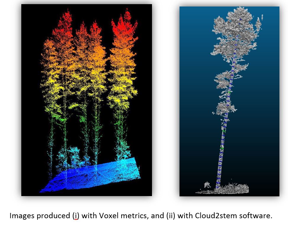
- Develop a set of ‘Voxel’ metrics that can be used to increase inventory accuracy over standard LiDAR metrics.
- New point clouds using Cloud2stem software will soon be able to accurately measure stem diameters.
- Identify needle mortality (and hence disease symptoms) using a UAV – this research involved simulating a disease outbreak by poisoning some trees so that changes in needle colour and foliar retention could be analysed.
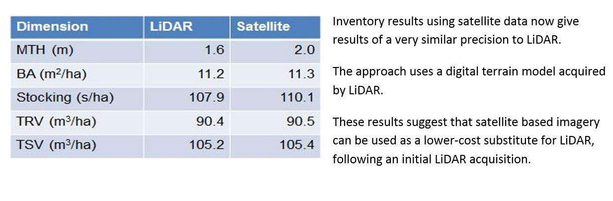
- Prove that satellite data can be an inexpensive and equally accurate alternative to LiDAR for inventory.
Presentation below.
- Document:
- Remote Sensing for Forest Owners - M Watt (2.36 Mb)